
New Satellite Data Reveals a More Dynamic Earth
Next-generation satellites provide unprecedented detail on land, oceans and the atmosphere, helping scientists track a rapidly changing planet.
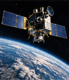
A new generation of Earth observation satellites is delivering a sharper, more comprehensive view of the planet, revealing faster changes in forests, ice, oceans and cities than previously recorded.
The Earth-observation project imagined here combines satellite images with ground sensors to examine a changing river delta. One instrument maps surface water, another provides information about vegetation and local teams check conditions at selected sites. Their combined record gives a fuller picture than any single dataset.
The challenge is to make that record comparable across years. Changes in instruments and processing methods can resemble environmental change if they are not documented. The fictional research team therefore publishes corrections and uncertainty estimates alongside its maps, allowing other analysts to test the same interpretation.
Illustrated inaugural edition · Fictional editorial copy