
New Satellites Sharpen View of a Changing Earth
A next-generation fleet is giving scientists unprecedented data on ice loss, forest change and methane emissions.
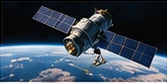
A next-generation fleet is giving scientists unprecedented data on ice loss, forest change and methane emissions.
The fictional satellite fleet revisits the same landscapes frequently enough to show change between seasons. Researchers can compare forest cover after a fire, follow the edge of a glacier or identify where further ground measurements are needed. The value comes from consistent observation over time.
Processing those images requires careful correction for clouds, viewing angles and differences between instruments. Teams publish quality flags so later users can distinguish a dependable measurement from an uncertain one. A sharper view is useful when it is accompanied by enough context to support reproducible analysis.
Illustrated inaugural edition · Fictional editorial copy